Guelph
Innovation
District

Keep updated on the Guelph Innovation District development process, and get involved by sharing your ideas below. Be sure to Register, and check back periodically for more updates.

Developing GID

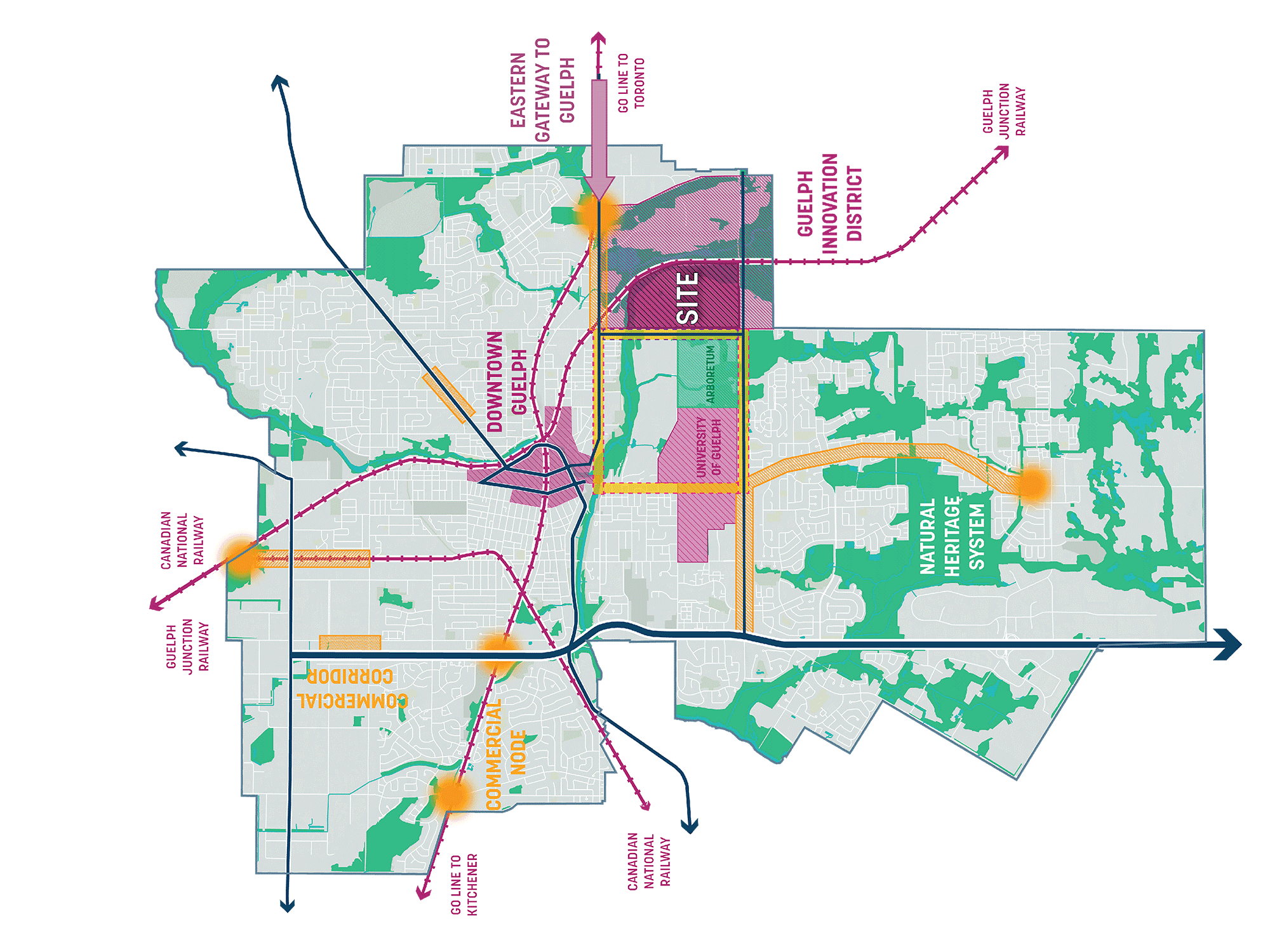
Planning and design work is being completed to implement the direction of the City’s Official Plan and the Guelph Innovation District Secondary Plan. A block plan has been submitted and we recently held our second Community Open House to share information and receive input.

Transforming the City of Guelph

The most significant development in Guelph's history.

Natural Heritage Systems

Commercial Mixed-Use Note

Information Center / Commercial Corridor / Growth Area

Opportunities for the Community

Special opportunities inform the master plan.

GID in Context

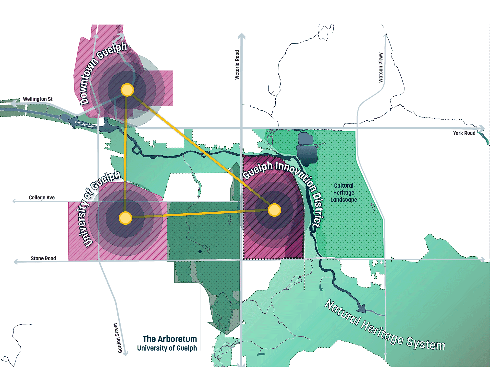
This is the first concept of the potential land use within GID. A city within a city.
An oblique aerial image of Santa Monica and Los Angeles from above Santa Monica Bay with the airport site highlighted and key features diagrammed over the city and region, including major roads, the Expo Line, major commercial centers, and parks.
An oblique aerial image of Santa Monica and Los Angeles from above Santa Monica Bay with the airport site highlighted and key features diagrammed over the city and region, including general water flow lines and Ballona Creek.
An oblique aerial image of Santa Monica and Los Angeles from above Santa Monica Bay with the airport site highlighted and key features diagrammed over the city and region, including major roads, the Expo Line, major commercial centers, and parks, and opportunities for view corridors from the airport site.

Guelph Innovation District

Developing GID

Planning and design work is being completed to implement the direction of the City’s Official Plan and the Guelph Innovation District Secondary Plan. A block plan has been submitted and we recently held our second Community Open House to share information and receive input.

Transforming the City of Guelph

The most significant development in Guelph's history.

Natural Heritage Systems

Commercial Mixed-Use Note

Information Center / Commercial Corridor / Growth Area

Opportunities for the Community

Special opportunities inform the master plan.

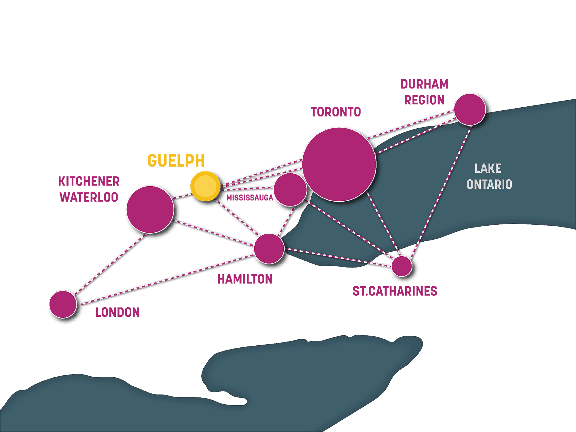
GID in Context

This is the first concept of the potential land use within GID. A city within a city.

An oblique aerial image of Santa Monica and Los Angeles from above Santa Monica Bay with the airport site highlighted and key features diagrammed over the city and region, including major roads, the Expo Line, major commercial centers, and parks.
An oblique aerial image of Santa Monica and Los Angeles from above Santa Monica Bay with the airport site highlighted and key features diagrammed over the city and region, including general water flow lines and Ballona Creek.
An oblique aerial image of Santa Monica and Los Angeles from above Santa Monica Bay with the airport site highlighted and key features diagrammed over the city and region, including major roads, the Expo Line, major commercial centers, and parks, and opportunities for view corridors from the airport site.

Imagine the Possibilities

Partners

Share Your Ideas

We respect your privacy and do not share your information with anyone.

We respect your privacy and do not share your information with anyone.

We respect your privacy and do not share your information with anyone.