Guelph
Innovation
District

Keep updated on the Guelph Innovation District development process, and get involved by sharing your ideas below. Be sure to Register, and check back periodically for more updates.

A New Hub on Ontario’s Innovation Corridor

Transforming the City of Guelph

The most significant development in Guelph's history.

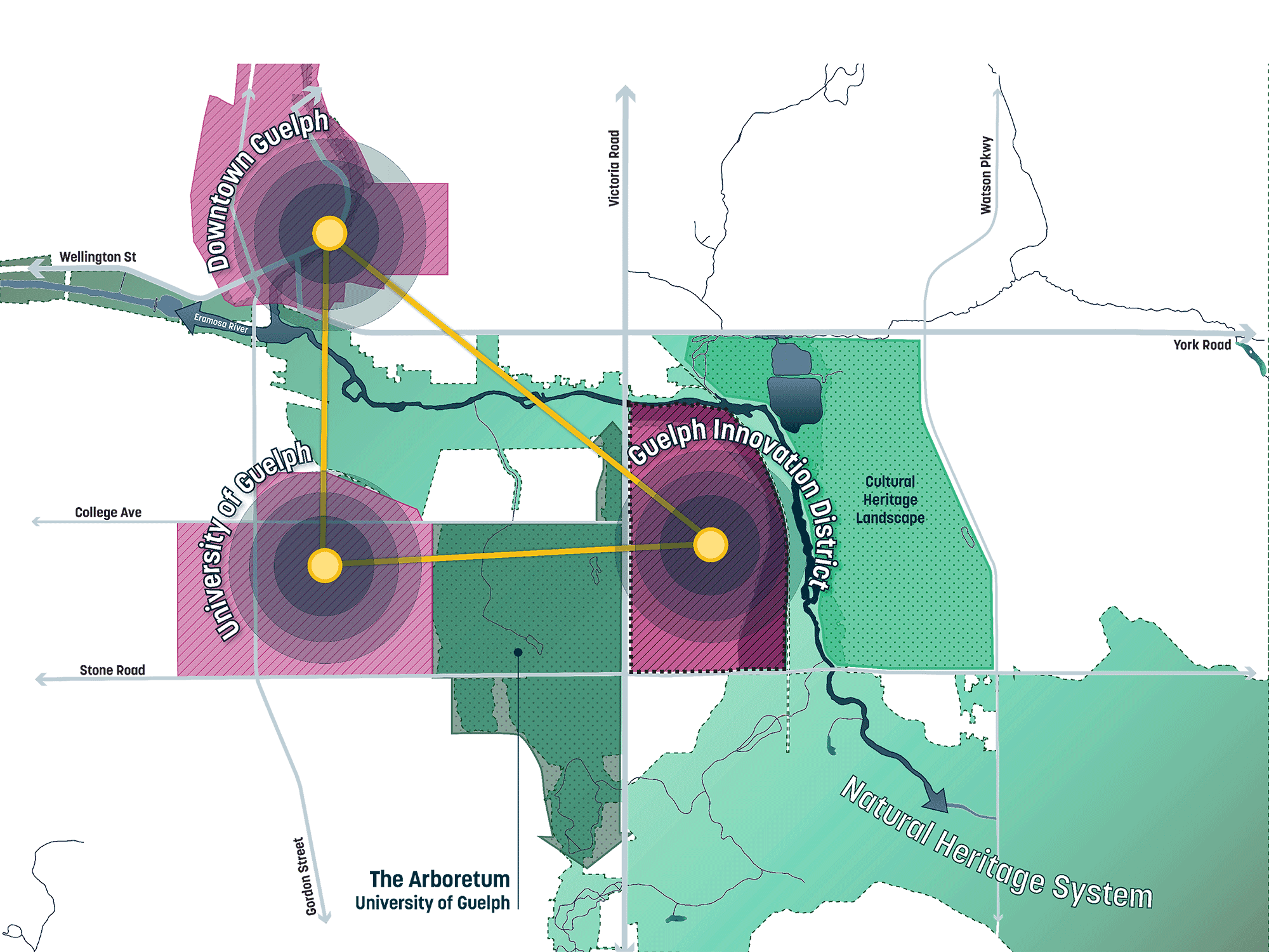
Guelph’s Innovation Triangle

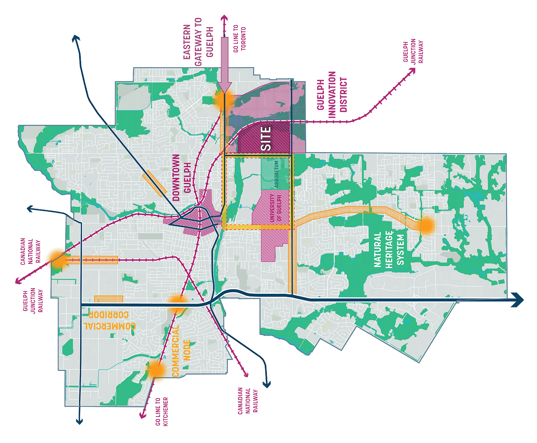
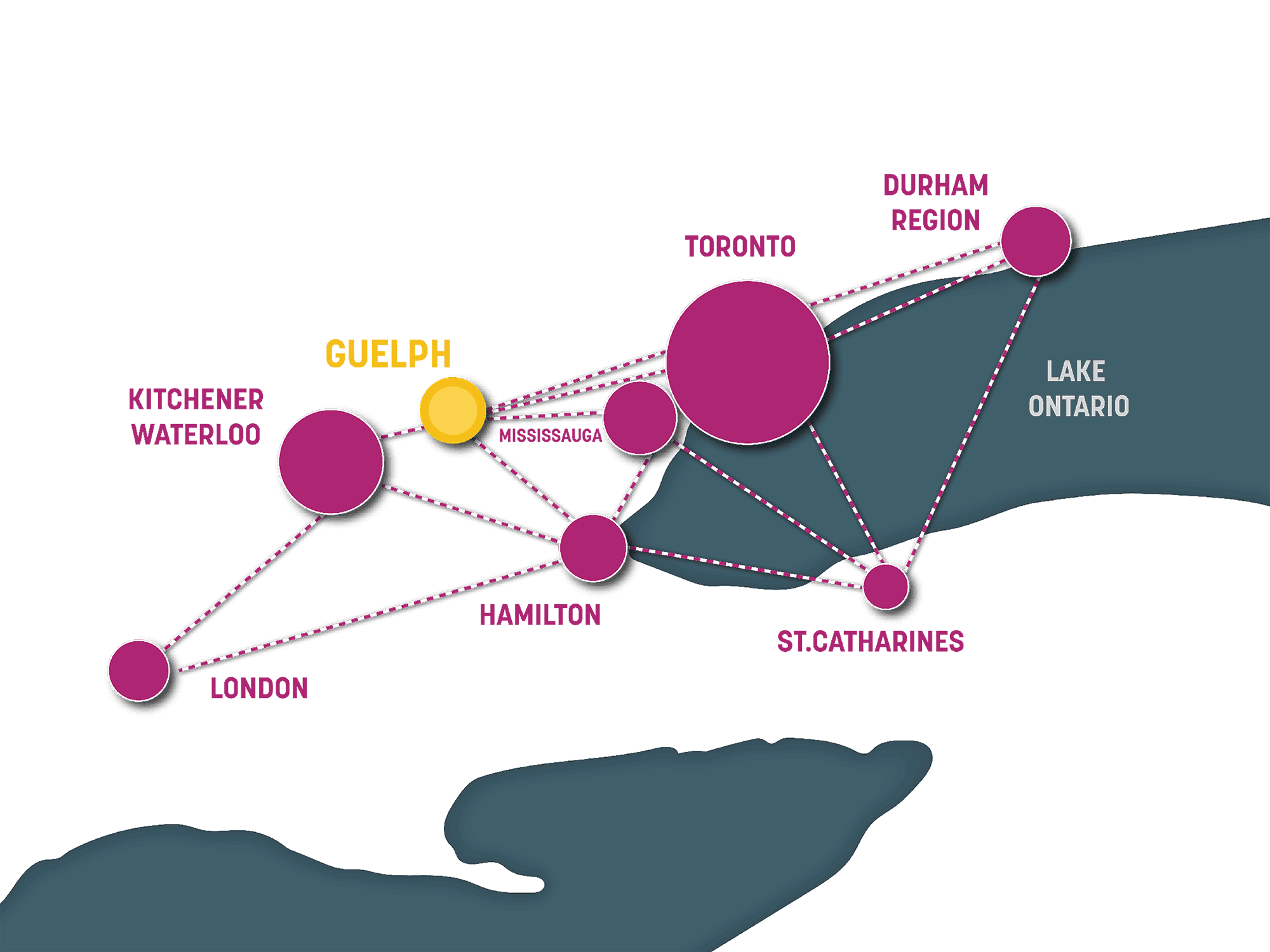
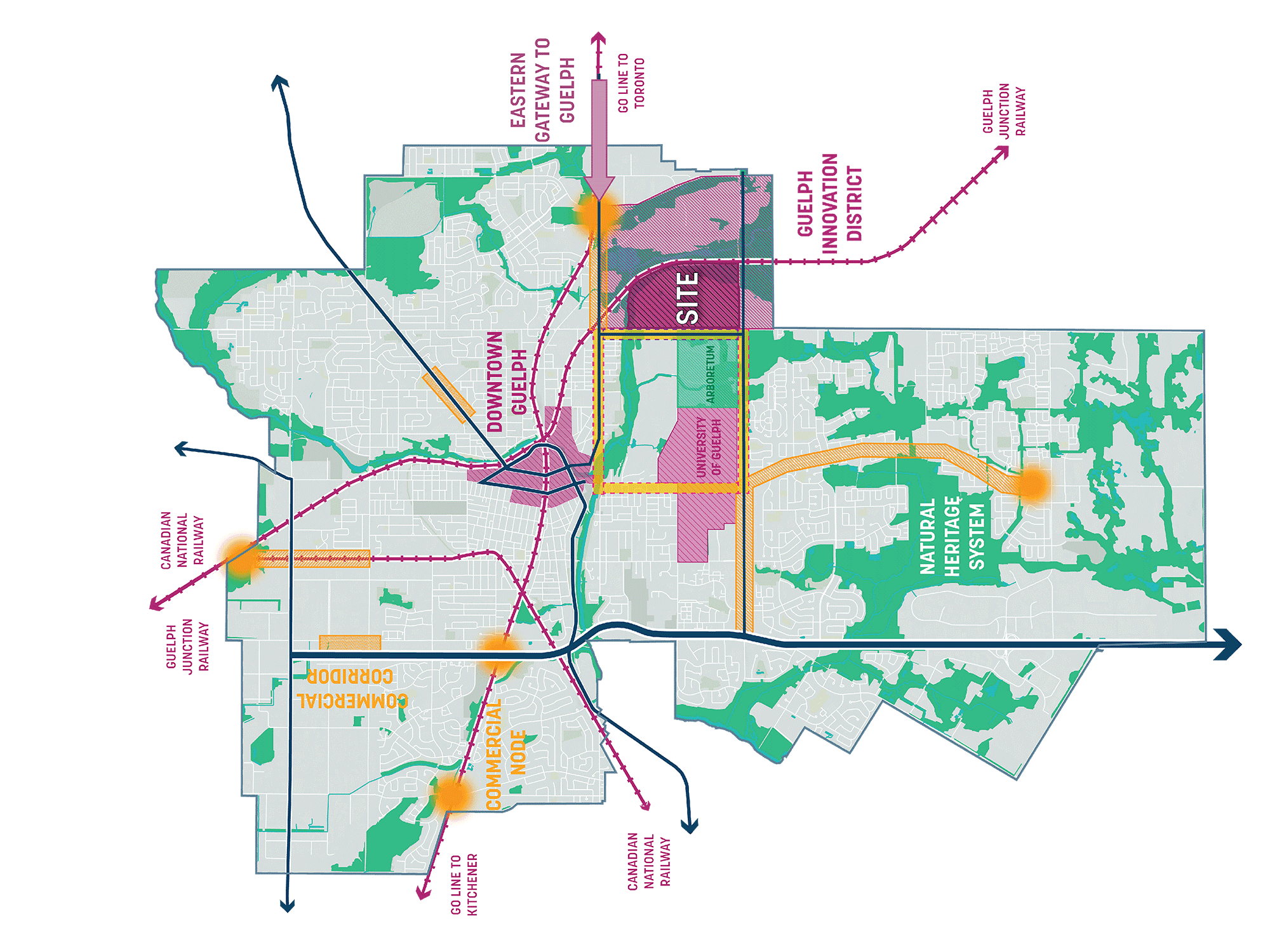
Locally, the Guelph Innovation District will form the third point in an innovation triangle that includes Downtown Guelph, with its emerging businesses and vibrant commercial activities, and the University of Guelph, with its academic and research programs supporting innovation at GID.

An oblique aerial image of Santa Monica and Los Angeles from above Santa Monica Bay with the airport site highlighted and key features diagrammed over the city and region, including major roads, the Expo Line, major commercial centers, and parks.
An oblique aerial image of Santa Monica and Los Angeles from above Santa Monica Bay with the airport site highlighted and key features diagrammed over the city and region, including general water flow lines and Ballona Creek.
An oblique aerial image of Santa Monica and Los Angeles from above Santa Monica Bay with the airport site highlighted and key features diagrammed over the city and region, including major roads, the Expo Line, major commercial centers, and parks, and opportunities for view corridors from the airport site.

Guelph Innovation District

Partners

Share Your Ideas

We respect your privacy and do not share your information with anyone.

We respect your privacy and do not share your information with anyone.

We respect your privacy and do not share your information with anyone.

Privacy Policy

Privacy Policy

Privacy Policy

Privacy Policy

Accessibility Policy

Accessibility Policy

Accessibility Policy

Accessibility Policy